Spherical region analysis
Region analysis turns masks or label fields into topology and geometry. A planar implementation is not sufficient for an ERP: its left and right edges are the same meridian, its pixels cover unequal solid angles, and a missing band must not connect regions merely because its numeric values are zero.
Each capability below is shown twice. The analytic figure isolates the mathematical contract; the real-image figure checks integration on the checksum-pinned CC0 Poly Haven Studio panorama. Its bright-region mask is a documented photometric heuristic, not semantic ground truth.
Read every real-image figure from left to right. The boxed line states the
actual public call as input type → S.operation(...) → output type;
numbered panels show those values; the final USE line states what that
result enables in an application. The photograph is gamma-lightened for
legibility only. All operations consume the original decoded values after the
sphere-aware resize.
Topology contract
connected_components uses 4- or 8-neighbour ERP pixel-centre adjacency
with periodic longitude. Latitude does not wrap. Unsupported or invalid
pixels are absent vertices, so they cannot bridge components. Positive labels
are deterministic and ordered by the first raster index of each component;
zero is background.
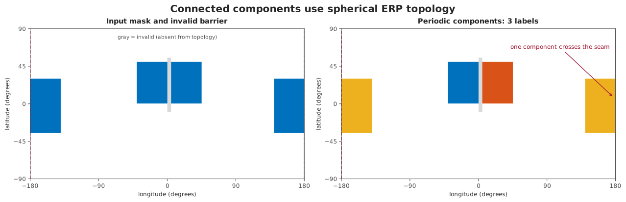
Longitude is periodic, latitude is not, and invalid samples are absent from the topology. The seam-crossing blue region therefore receives one label; the gray barrier separates the central region.
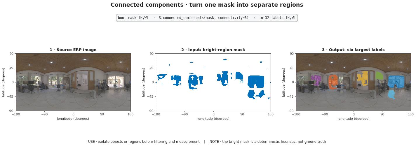
Real-image check. The source is loaded through EquirectangularImage and
resized sphere-aware. The six largest components are selected by solid
angle for display; the computation retains all 25 components. The bright
openings and lamps make each retained region visually identifiable.
watershed floods the same graph from positive integer markers. It
minimizes the maximum gradient along a path, then path length; the smaller
marker label resolves a remaining tie. Marker pixels never change. This is a
declared discrete graph watershed, not a planar watershed applied to an ERP
rectangle.
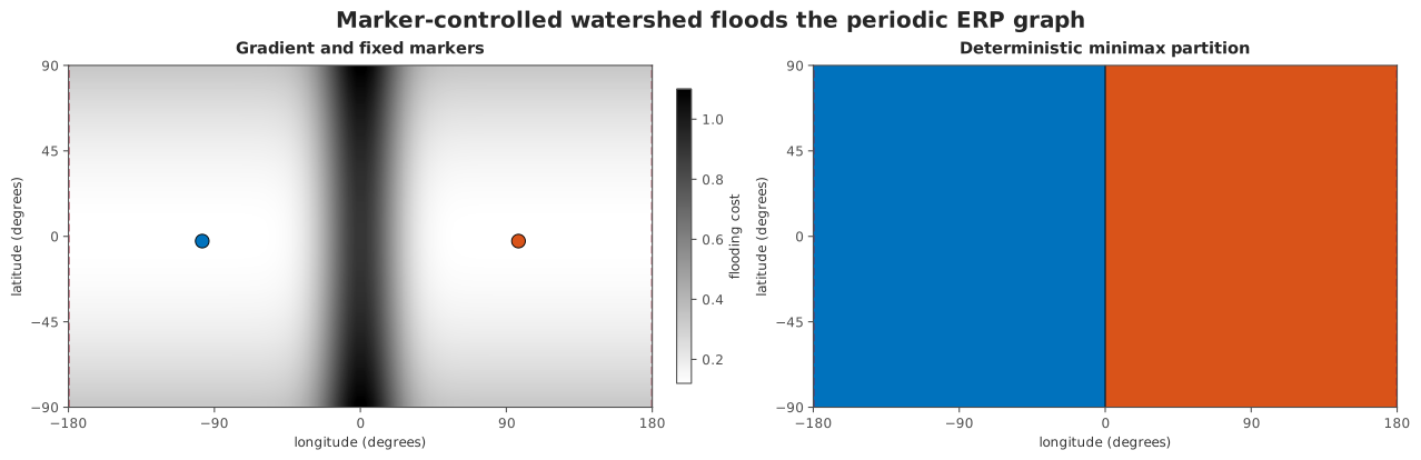
Marker-controlled watershed operates on the same periodic graph. Fixed markers and deterministic tie-breaking make the partition reproducible.
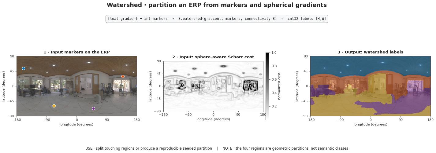
Real-image check. Each marker is the lowest Scharr cost inside one of four fixed windows. The resulting regions follow real image ridges; they are geometric partitions, not semantic classes.
Distance and boundaries
geodesic_distance_transform builds unit bearings for ERP centres and
returns the exact great-circle angle to the nearest selected centre. Values
outside support or validity are NaN, not zero. region_boundaries uses
topological neighbours and never invents a boundary at the longitude seam.
Angular perimeter is measured along cell interfaces. North-south interfaces
have length \(\Delta\phi\); east-west interfaces at latitude
\(\phi\) have length \(\cos(\phi)\Delta\lambda\). Solid angle comes
from the existing spherical core and sums to \(4\pi\) over a complete
ERP. Centroids are normalized solid-angle-weighted bearing sums. Symmetric
regions whose vector sum is undefined return None rather than an arbitrary
direction.
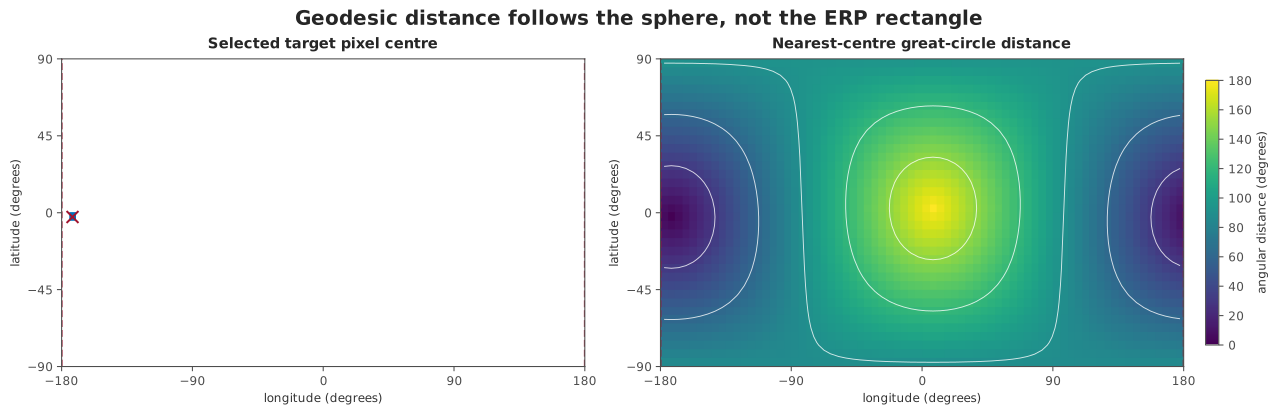
Equal colors mean equal angular distance on the sphere. They do not form Euclidean circles in the ERP rectangle, and the field remains continuous across the two displayed longitude edges.
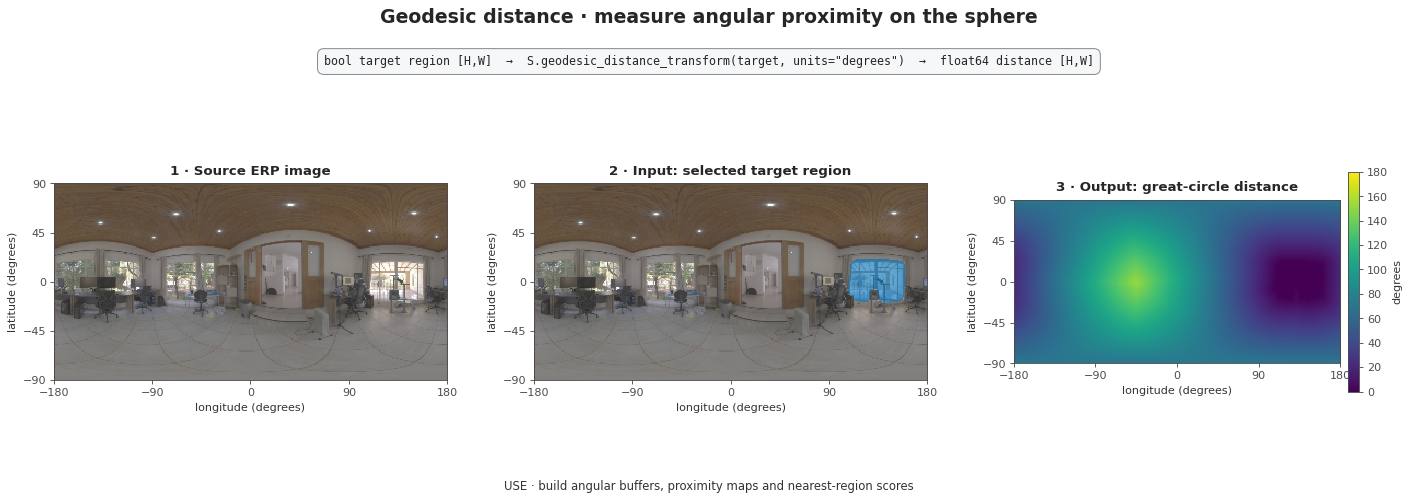
Real-image check. Distance is evaluated from every ERP centre to the largest connected bright-region candidate and reported in degrees.
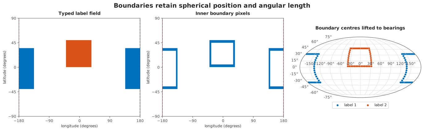
Raster boundaries can be retained as a typed mask or lifted to unit bearings. No artificial contour is introduced where the ERP is cut for display.
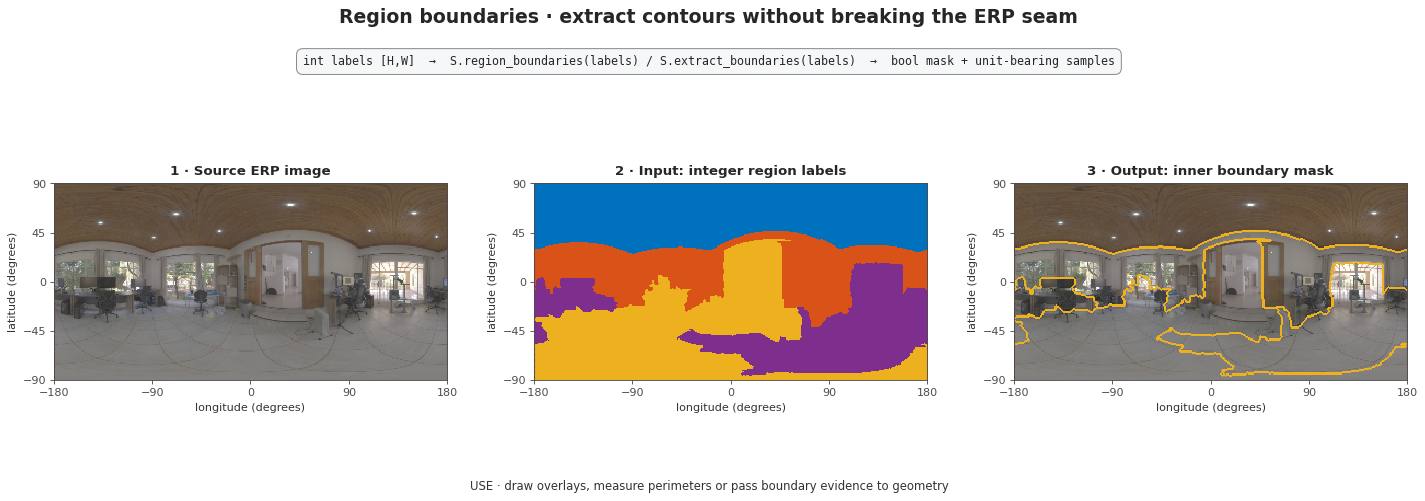
Real-image check. The yellow inner boundaries follow the real-image watershed and remain continuous at the longitude seam.
Ordered contours and medial axes
trace_contours follows ERP cell interfaces rather than sorting boundary
pixel centres. Its vertices are therefore ordered, sub-pixel locations. The
longitude seam is periodic and every cell corner on a polar edge is collapsed
to the corresponding pole. A contour next to missing support or invalid data
is open by default: closing it would assert a boundary that was never
observed. Set include_support_boundary=True only when that explicit domain
edge is the boundary an application intends to measure.
skeletonize returns a sampled spherical medial axis. It computes exact
great-circle distance to the background at ERP pixel centres and retains
intrinsic local ridges across opposite neighbour pairs. The result is a
deterministic subset of the input mask, respects the longitude seam, never
crosses invalid data, and can discard branches below a declared angular
radius. This is not planar thinning applied to a wrapped rectangle. A mask
filling its complete supported domain has no distinguished medial axis and
fails explicitly.
Holes on a closed sphere
A sphere has no privileged exterior component. fill_holes therefore
requires max_hole_solid_angle_sr. It fills only background components no
larger than that physical area and never fills a component touching missing
support or invalid data. The threshold is part of the scientific method, not
an implementation detail.
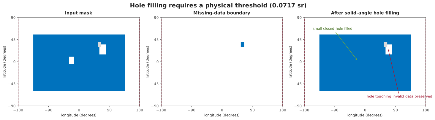
The physical threshold fills the small closed component. A component that touches missing data remains unresolved instead of being silently treated as an interior hole.
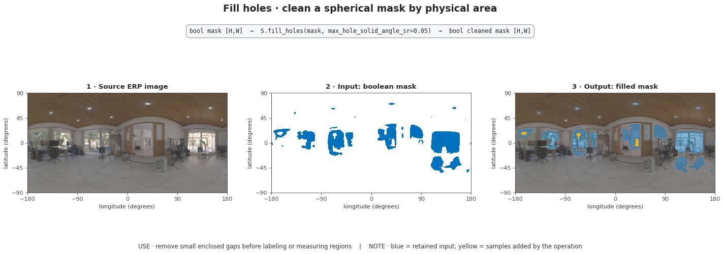
Real-image check. Yellow samples are background components no larger than
0.05 sr that were filled; blue samples were already selected by the
photometric heuristic.
Measurements and adjacency
measure_regions and region_adjacency_graph expose complementary
descriptions of a label field. Per-region values use spherical area,
solid-angle-weighted centroids and angular perimeter. Graph edges store shared
angular boundary length rather than a count of ERP pixels.
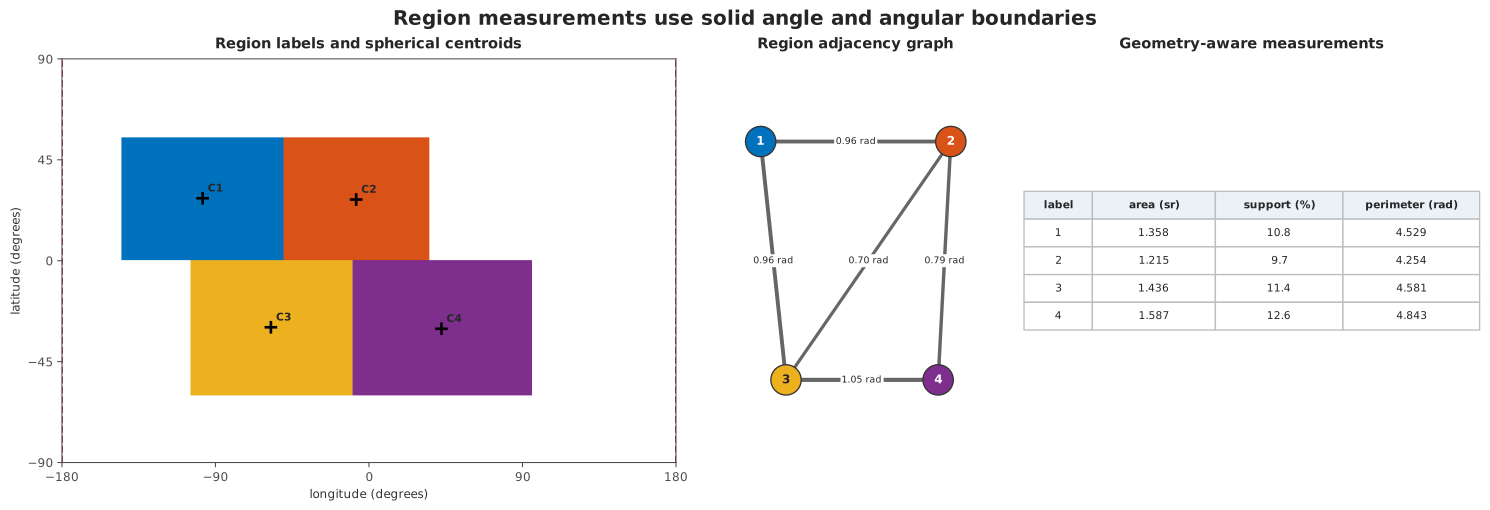
The raster, graph and table describe the same four regions. Measurements remain comparable across latitude because they are expressed in steradians and radians rather than raw pixel counts.
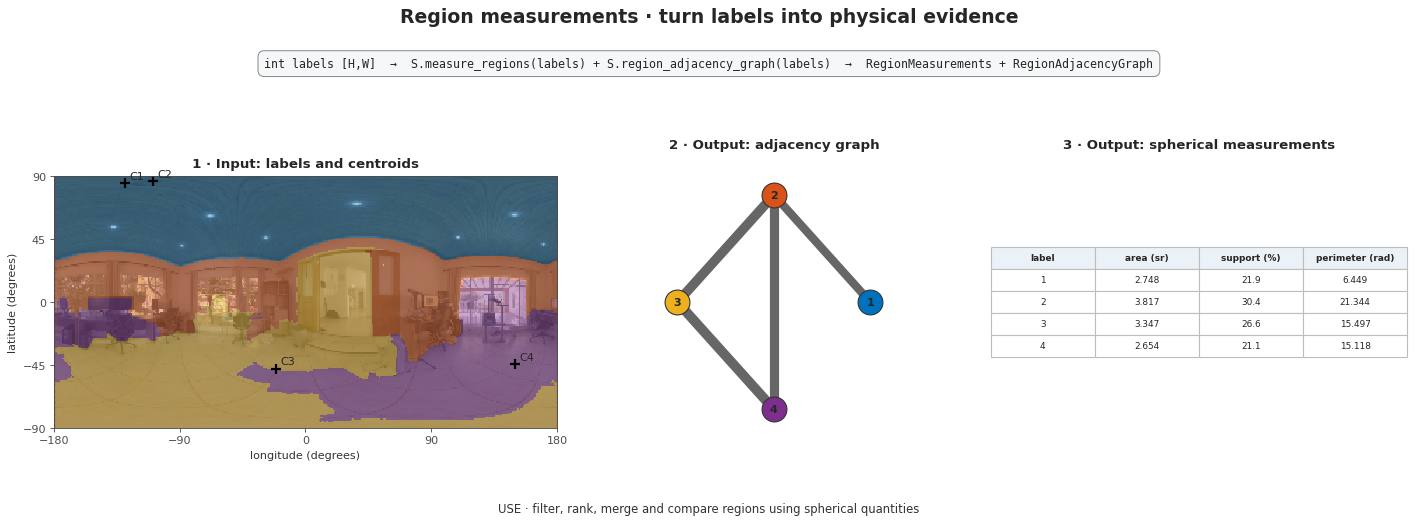
Real-image check. The four partitions cover \(4\pi\); their centroid, area, perimeter and five adjacency edges are computed from spherical geometry rather than ERP pixel counts.
API placement
Functions and configured raster operations live in
panorai.ops.spherical. Configured operations compose through
EquirectangularImage.apply_spherical or OnSphere and safely persist in
a Pipeline. SphericalWatershed is a two-field Stage; AnalyzeRegions
turns a label field into RegionAnalysisResult. Immutable measurements,
adjacency graphs, conservative enclosing caps, boundary samples and ordered
contours live in panorai.data.
The Stable SphericalBoundary type intentionally stores unordered pixel-centre bearing samples.
SphericalContour is the separate ordered cell-edge contract; neither is
mislabeled as a filled spherical polygon.